
Sarek Crossing – 130km Self-Supported Winter Traverse
Sarek Crossing – 130km Self-Supported Winter Traverse of Sweden’s Wildest National Park
A Journey Through Sarek’s Pristine Wilderness
This 130km self-supported winter journey begins in Ritsem and concludes at either Kvikkjokk or Saltoluokta, depending on conditions and team ambitions. The route navigates through the heart of Sarek National Park, primarily following frozen rivers, lakes, and broad valleys.
Starting at approximately 500 metres above sea level, the journey crosses relatively flat terrain before ascending into the Ráhpavágge (Rapadalen) valley at nearly 1000 metres, with surrounding peaks rising close to 2000 metres. Among these is Sarektjåkkå, the highest mountain in Sarek and the second-highest in Sweden, standing at 2089 metres.
The expedition avoids marked trails, relying instead on natural features and occasional reindeer tracks for navigation. Wildlife sightings may include ptarmigan, reindeer, and, on rare occasions, wolverine.
In February, typical daytime temperatures range from -12°C to -6°C, with overnight lows potentially reaching -27°C. Wind speeds average around 25 km/h, and snowfall is frequent, contributing to a snowpack that can exceed 550 cm.
This expedition is suited for those seeking a remote and challenging winter experience in one of Europe’s most rugged environments.

The Crossing Highlights
Approximately 130km unsupported winter crossing through Sarek National Park

Frequent snowfall, temperatures down to -27°C, and average wind speeds around 25km/h

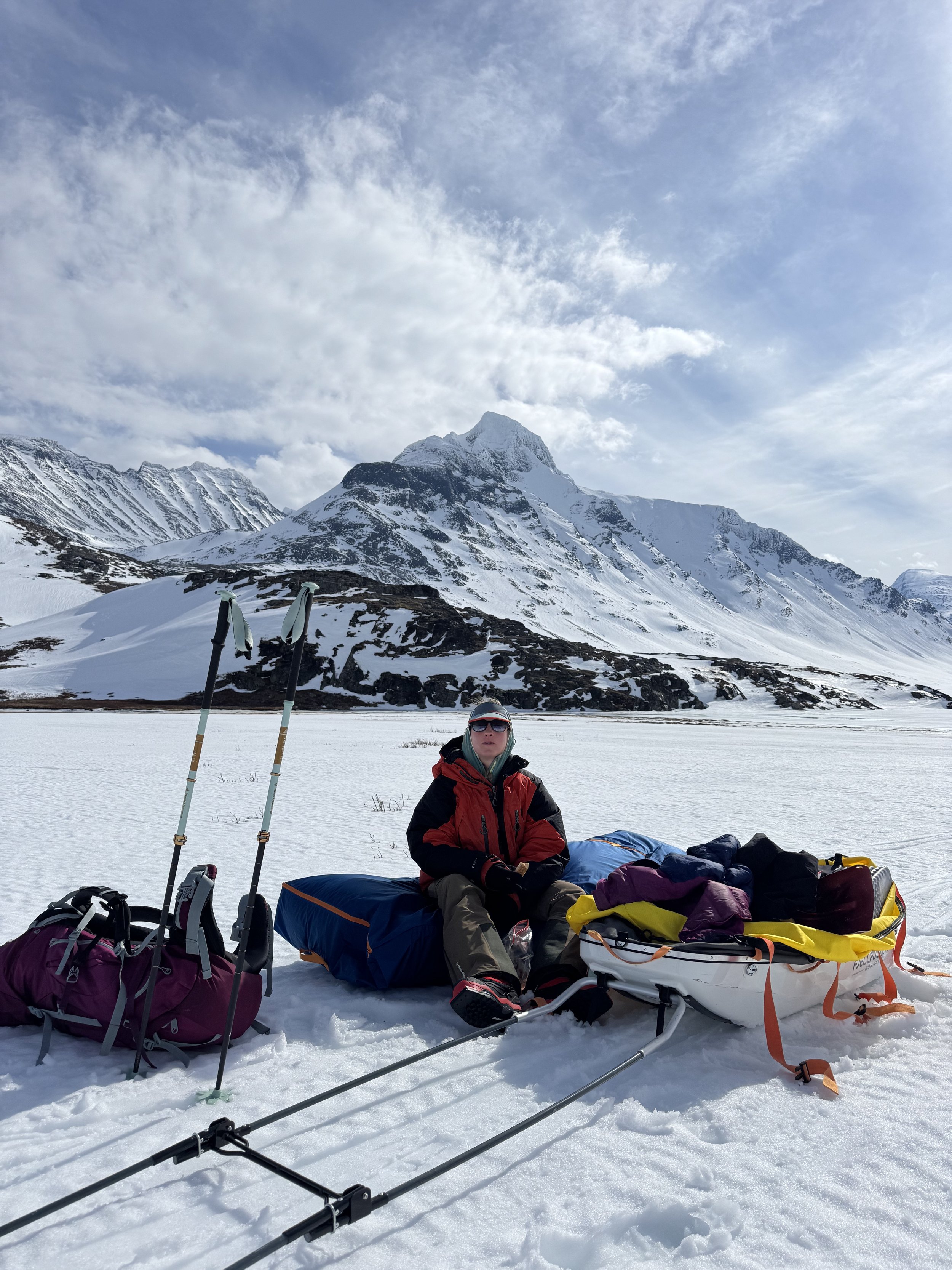
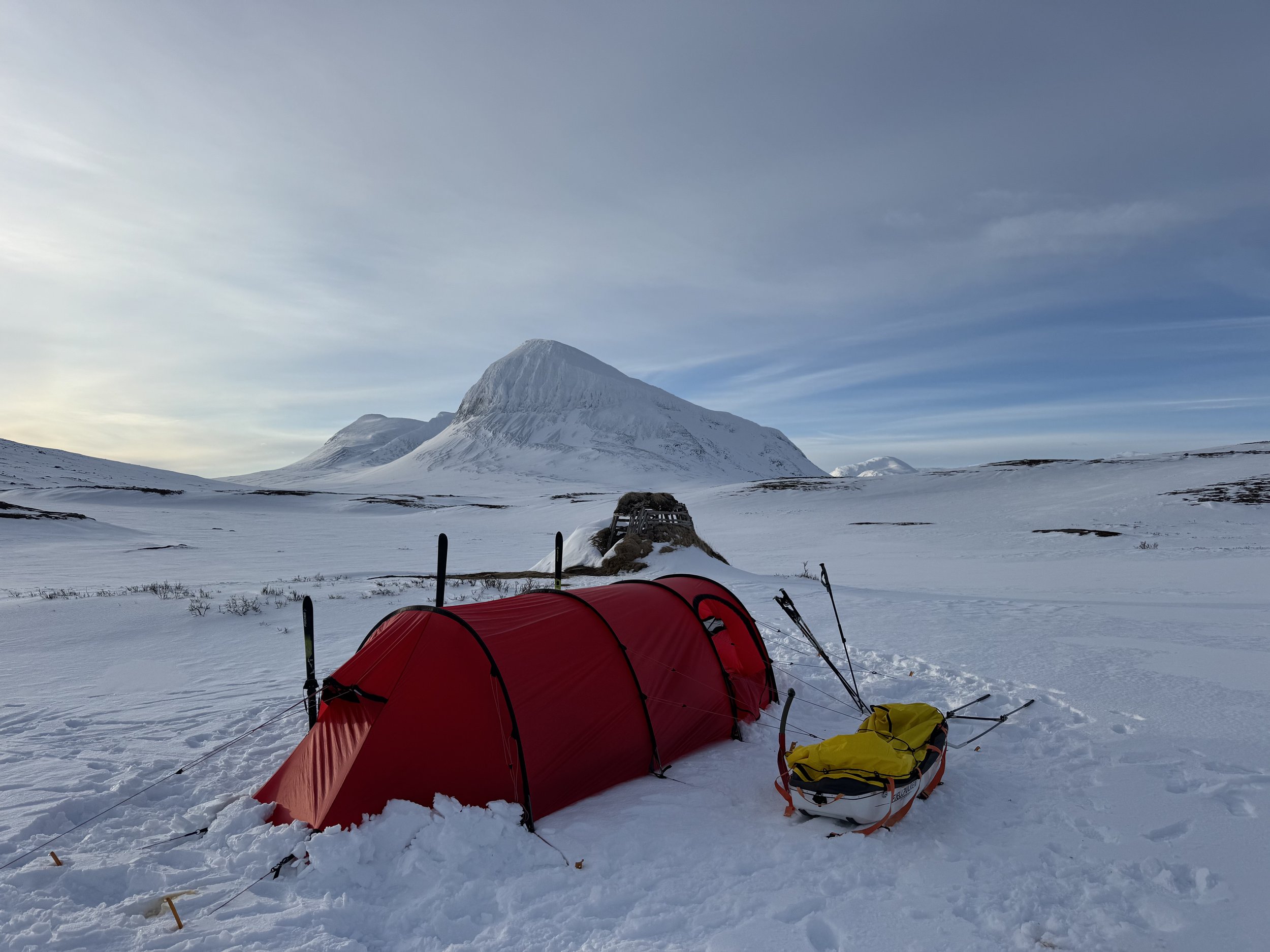
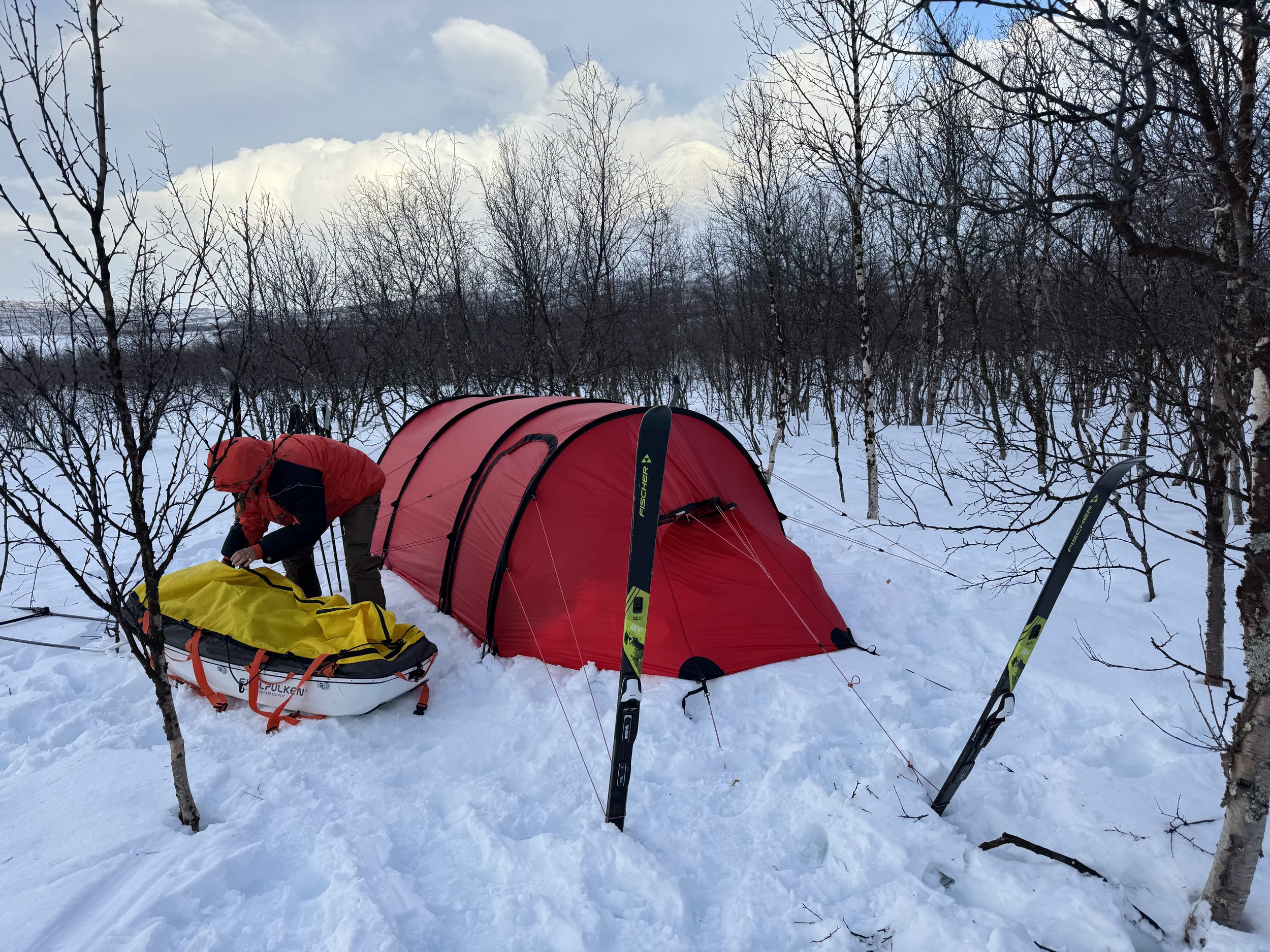
Full winter expedition living: pulk hauling, tent camping, cold weather routines

Remote route mainly following frozen rivers, lakes, and valleys

Wild terrain ranging from open plateaus at 500m to the Rapadalen valley at 1000m

Below is a map of the area we will be journeying through!


What to Expect During Your Crossings
A serious winter journey across remote ground
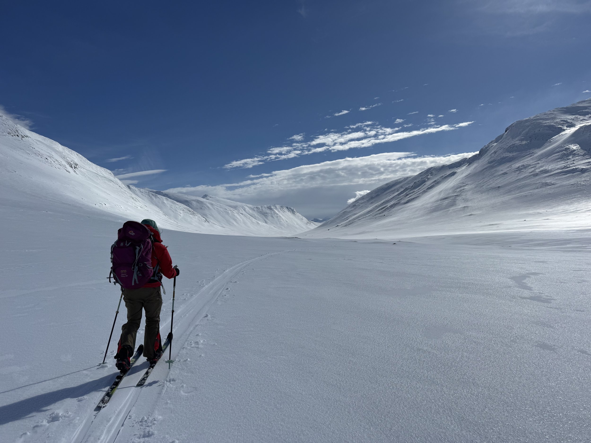
The Sarek crossing is a self-supported journey through one of Europe’s most isolated environments. The terrain is largely untracked, and days are spent travelling along frozen rivers, through broad valleys, and across open plateaus, with no external resupply points. Decision-making, efficiency, and resilience in cold weather are key throughout.
Light and conditions
In February, daylight hours are gradually increasing but remain short, typically providing around 7 to 9 hours of usable light. Temperatures can fall below -20°C, with daytime averages between -12°C and -6°C. Snowfall is frequent, and fresh drifts are common, alongside strong winds, particularly across exposed sections of the route.
Skills you’ll develop
Participants will refine skills essential for independent winter expeditions, including polar campcraft, efficient pulk travel, cold weather routines, and winter navigation techniques. The experience offers a genuine platform for those looking to progress towards more committing Arctic journeys.
Frozen rivers, valleys, and high plateaus
The crossing begins at around 500 metres above sea level on relatively flat terrain before steadily gaining height into the main Rapadalen valley at nearly 1000 metres. Peaks up to 2089 metres, including Sarektjåkkå, line the journey. The route makes use of natural corridors across frozen waterways, with careful attention paid to snow and ice conditions.
Wildlife and environment
The Sarek landscape in winter is raw and stripped back, with signs of life limited to well-adapted Arctic species. Tracks of reindeer, ptarmigan, and Arctic fox are often seen. Sightings of wolverine, though rare, are possible. The environment is quiet, still, and serious — a place where movements must be efficient and deliberate.
A progression towards larger Arctic objectives
This expedition is suitable both as a standalone achievement and as part of a progression towards more advanced Arctic crossings. The experience gained in route-finding, winter camp management, and self-sufficiency lays the groundwork for longer polar journeys in harsher and more remote environments.
We only have limited places on each expedition, get in contact today and reserve your spot on our next adventure.
Expedition Safety
Your Safety is Our Top Priority on Every Trip
Every Nordur expedition is designed with a strong focus on safety, based on years of leading teams in remote and extreme environments. The Sarek crossing is no exception. The park is located far north within the Arctic Circle, and operating earlier in the season means temperatures are lower, daylight is limited, and conditions can be more severe than many other European winter routes.
Our guides are experienced in winter navigation, remote first aid, cold weather management, and emergency decision-making. During the crossing, we carry appropriate emergency equipment, including satellite communications (InReach and satphone), group shelter systems, full medical kits, and personal locator beacons.
Participants will be provided with a comprehensive equipment list well in advance of departure. Pre-expedition support is available for equipment discussions and preparation. A UK-based winter expedition training course is also included as part of the Sarek crossing, covering critical skills and routines needed for unsupported winter travel.
Group equipment includes Hilleberg Keron 3GT tents, Snow Sled pulk systems, stoves and fuel, and essential expedition safety gear.
While the risks involved in remote Arctic travel cannot be removed entirely, every reasonable step is taken to manage and mitigate them through planning, experience, and careful decision-making in the field.
Your Polar Training Expedition Itinerary
Day 1: Arrival in Gällivare
Arrive into Gällivare, or travel from Kiruna if arriving there. We meet as a group at the Grand Hotel opposite the train station for final checks and briefing. There’s time to repack equipment, collect any last supplies, and discuss the conditions ahead. Overnight in Gällivare.
Day 2: Transfer to Ritsem and start across the frozen lake
An early bus transfer takes us west to the outpost of Ritsem. After preparing pulks, we descend along skidoo tracks past the harbour towards the inlet. Our first major task is to cross a 10km stretch of exposed frozen lake, passing scattered islands and gaining impressive views into the valleys ahead. Winds can be strong here, so efficient movement is key. On reaching the far shore, we move into birch forests and establish camp, making use of shelter from any weather.

Day 3: Crossing rivers and climbing into the valleys
Leaving the forest, we work our way across broken terrain towards a major unfrozen river, negotiating steeper ground and occasional side slopes. A short but steep climb follows after a suspension bridge crossing, with pulks dragged or carried over the slope. Higher up, the ground opens into undulating plateaus with rimed summits towering above. Moving away from summer trails, we ascend into quieter side valleys, eventually camping near a traditional Sámi summer shelter.

Day 4: Gaining height towards the watershed
The day begins with steady travel across river beds and small plateaus before climbing into a high basin at the centre of the park. This section features ring contours and complex terrain, gradually rising towards the watershed. A small emergency hut sits near the highest point, offering shelter if needed. Surrounded by steep peaks, the atmosphere feels more Arctic than Alpine. We descend gradually into wide valleys, camping at around 20km distance from the morning’s start.

Day 5: Moving through wide valleys and avoiding the Rapa Valley
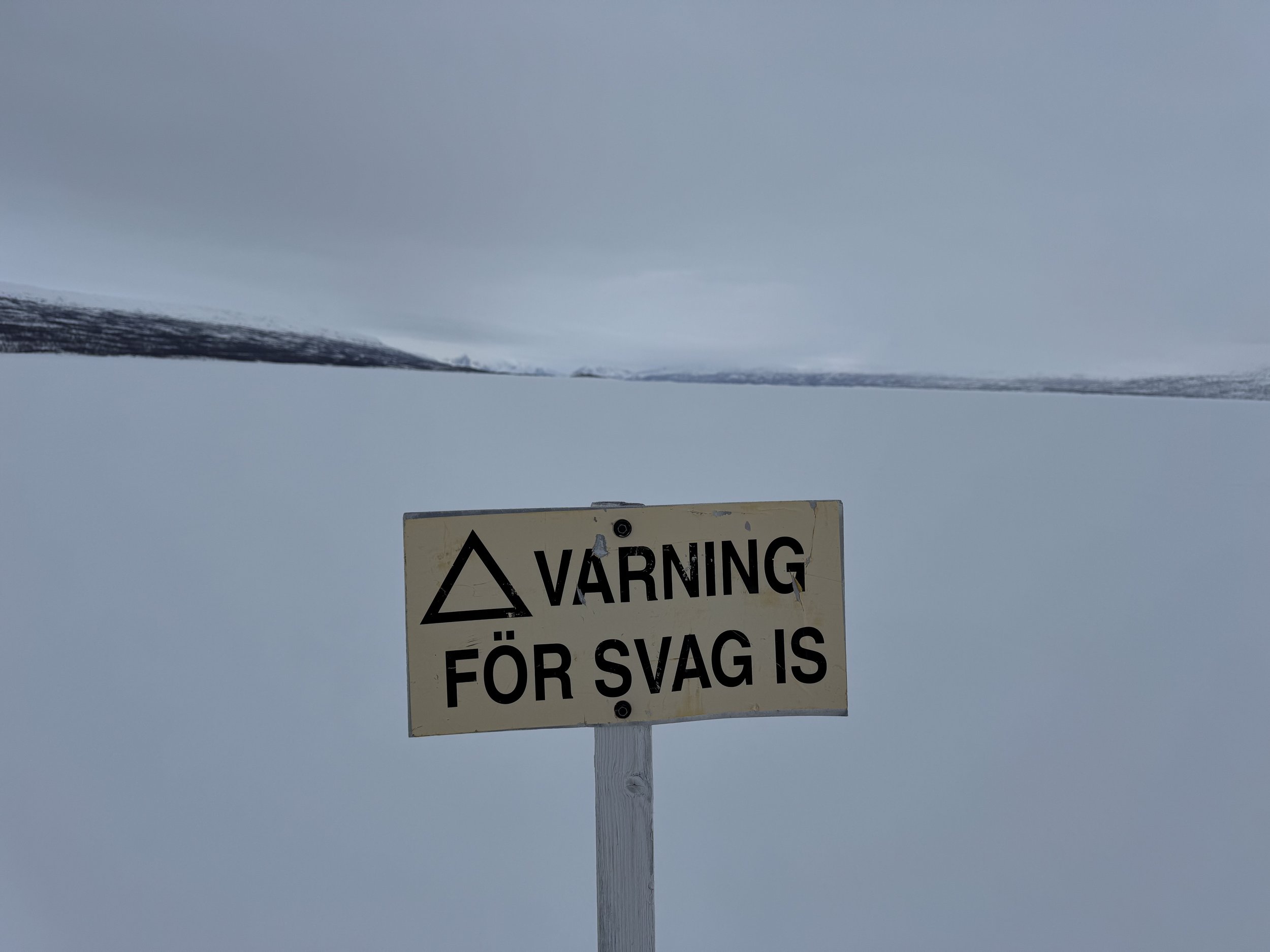
Progress continues along wide open valleys where maintaining height becomes important to avoid unnecessary climbs and descents. The landscape remains dramatic, with hanging glaciers and steep faces flanking our route. Snow conditions can vary, and open water at river crossings may need careful avoidance. Campsites are plentiful, with options for sheltered pitches amongst the valley sides and frozen lakes.

Day 6: Through moraine fields and onto large lake systems
Terrain becomes more complex as we cross moraine-like fields, skirting rock outcrops and small frozen lakes. Navigating this ground takes patience, particularly in areas where snow cover is thin. Eventually the route drops towards a larger interconnected lake system, offering a more open and straightforward travel surface. Camps are made along the shores of the larger lakes, often finding shelter near the banks or low ridges.

Day 7: Final crossings and descent to the lowlands
An early start sees us crossing frozen lake surfaces, although caution is needed with areas of new or thin ice. Beyond the lakes, we pick up a shallow river valley and begin the long descent towards the edge of the park. The first sections pass through birch forests, before tightening into a narrow gully where snow quality can become challenging. After working through these obstacles, we eventually reach the lower valleys and the outskirts of the settlements. A final traverse across the lake brings us back towards civilisation.
Day 8: Flexibility days for weather or onward travel
The itinerary includes flexibility days to allow for slower progress, adverse weather, or to continue further south towards Kvikkjokk. Depending on the conditions and group ambitions, these days may also offer options for rest, skills consolidation, or minor peak ascents near the route.
Day 09: Arrival at Kvikkjokk or Saltoluokta and return to Gällivare
The final day of travel brings the group to either Kvikkjokk or Saltoluokta. After a night at one of the STF mountain stations or nearby accommodation, we arrange transfer by public transport or private shuttle back to Gällivare.

Day 10: Departure
After a final night in Gällivare, participants depart for onward travel home.
Reserve your place on the next Sarek Crossing!
If you’re ready to take on a serious, self-supported winter journey through one of Europe’s most remote national parks, we would love to hear from you. Places are limited to maintain small group sizes and ensure a genuine expedition experience.
Please get in touch to discuss availability, experience requirements, and any questions you might have about the Sarek Crossing.
But don’t take our word for it have a look below at the media reel that shows you some of the highlights on offer during the week.
Our Sarek Crossing Photo Gallery


The Details
Cost per place on the expedition: £3495
-
Accommodation – 1 night hotel, 8 nights tented
Transfers from Gällavare to trail head and from Trail finish back to Gällavare.
Meals – 8 breakfasts, 8 lunches and 8 evening meals
Use of pulk system
Mountain tents, stoves and pans
Expedition food and fuel
Medical safety equipment and supplies
Expedition team leader
Access to our RMS team of doctors (please see website information for more details)
-
Travel to and from departure airport and to and from Gällavare
International flights and taxes
Personal equipment
Travel insurance
Drinks, snacks and personal spending
-
This expedition is open to those with good fitness and a strong mindset for winter conditions. No prior polar travel experience is required, but experience with multi-day trekking or mountain journeys is beneficial. You’ll be skiing or snowshoeing long distances, pulling a pulk, and sleeping in tents as part of a self-supported journey. The focus is on learning through experience, so adaptability and a willingness to develop new skills are key.
-
9 night in polar tents, 1 night in hotel.
-
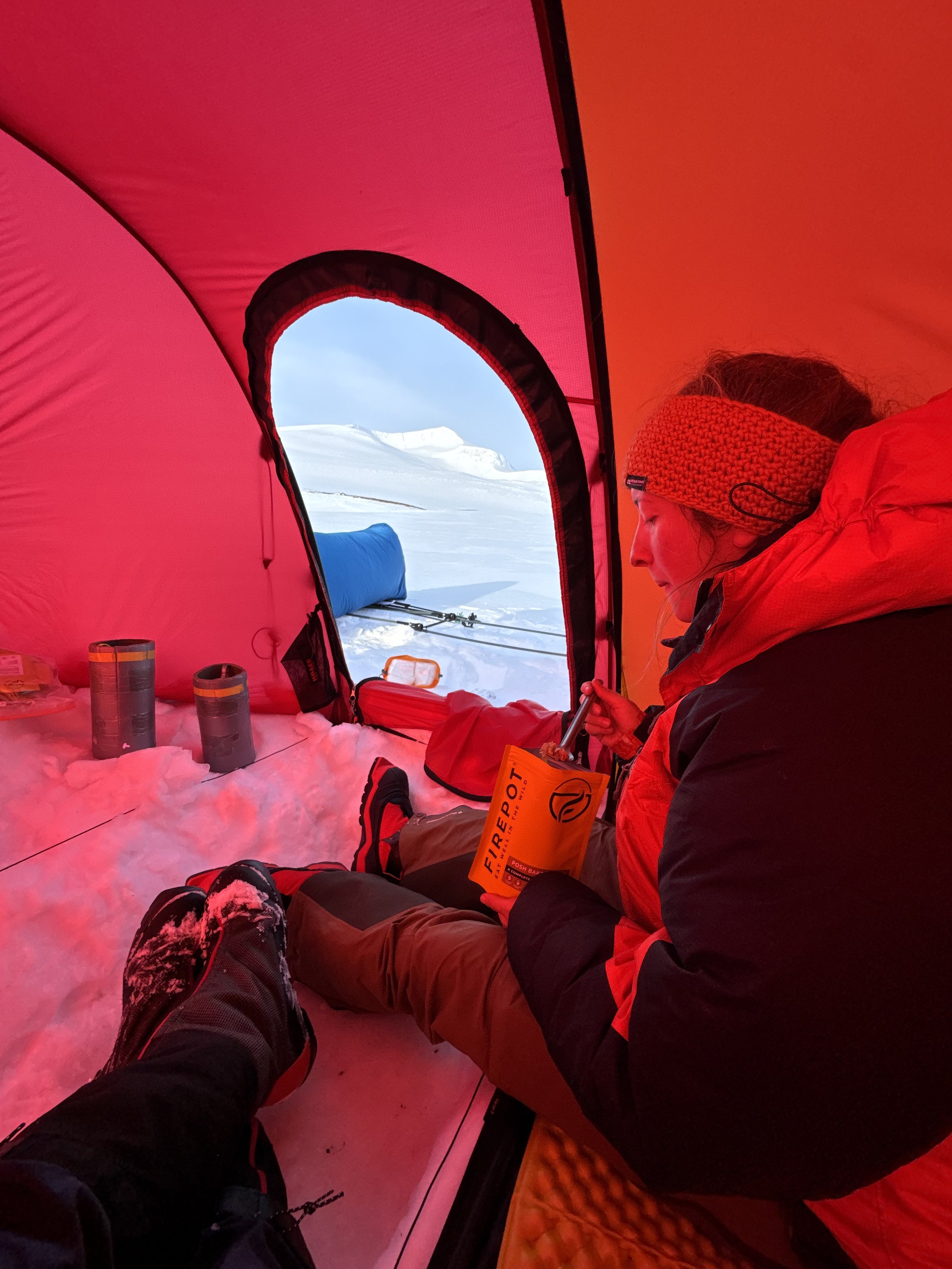
We will have a substantial ration breakfast to start the day. Lunches consist of individual ration packs with picnic style foods and high energy foods. Evening meals will consist of expedition food, which each of us will prepare on their liquid stove.
If you have food allergies or intolerances, please inform us in your Booking Form. There is a huge selection of expeditions rations these days in almost all cases we can make all dietary requirements work. Speak to us if you have any concerns.
-
This is an unsupported crossing – for the duration of the trip, you will pull a pulk, containing all of your equipment. The pulk will be strapped on with a waist and shoulder harness, connected to the pulk with rigid bars.
-
All our UK leaders hold first aid certificates and carry a fully equipped first aid kit for emergencies. We recommend that you carry a personal First Aid kit and hand sanitizers / antibacterial wipes as well as any personal medical requirements.
When selecting your trip please carefully read the information and itinerary and assess your ability to cope with our style of travel. Please refer to the trek rating for trip specific information. If you have any concerns, please contact us before booking. Nordur reserves the right to exclude any traveller from all or part of a trip without refund if in the reasonable opinion of your guide they are unable to complete the itinerary without undue risk to yourself and/or the rest of the group.
-
Visas for entry into Sweden are not required by nationals of the UK, Ireland and most EU countries. Contact your local embassy, or consulate for the most up-to-date visa requirements. It is your responsibility to have the correct travel documentation.
-
The local currency is Swedish Kroner (SOK). In almost all circumstances payment on card is possible. I rarely carry cash to Scandinavia.
-
Please scroll down and you will see the dates
